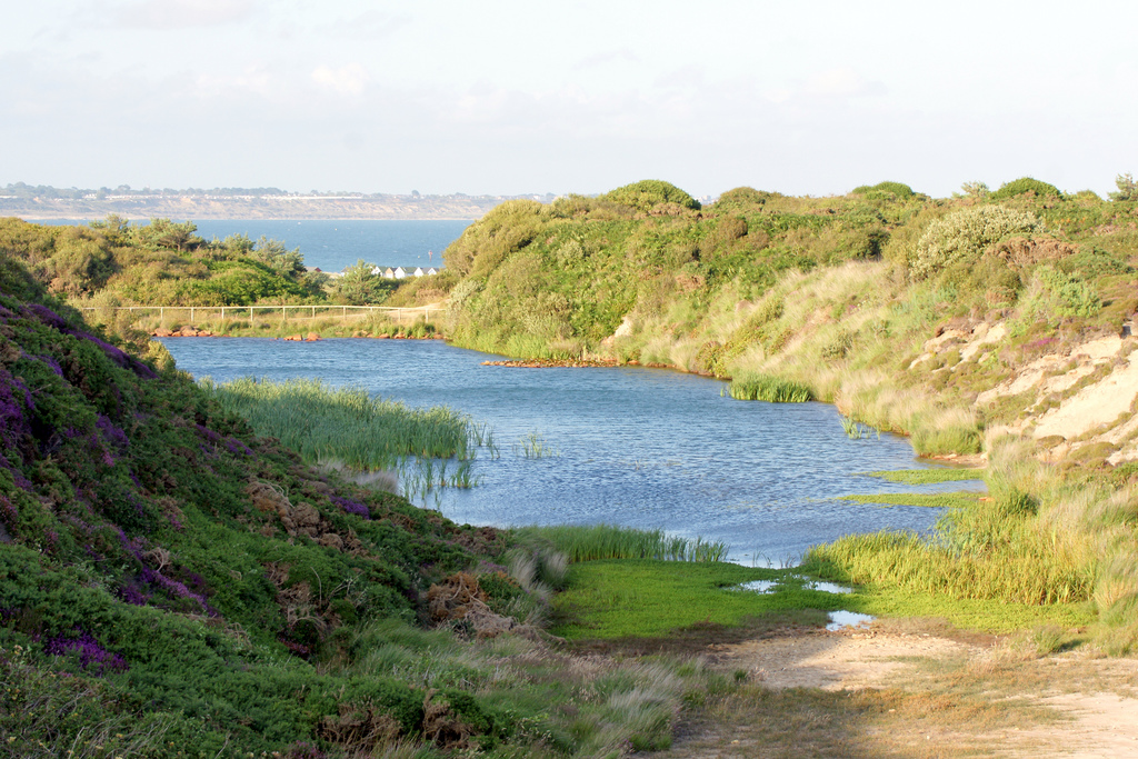
Hengistbury Head Ironstone Quarry Description A small ironstone quarry
mine that is located at Hengistbury Head. The mine was in use between
1848 and 1854 and consisted of the mine/quarry area, spoil heaps and a
harbour for the transportation of the ore. The quarry area of the site
has since been flooded to provide a wildlife sanctuary and the remaining
spoil heaps are covered in scrubland. The area is scheduled and is
classed as an area of Special Scientific Interest. from Historic England pastscape.org
The Quarry Pool is now a significant part of the nature reserve
features of the Head. While it was very acidic in the early years, since
1990 it has allowed the growth of a significant number of plant and
insect species, as well as mallard and little grebe. The insects provide valuable food for migrating sand martins and swallows. Wikipedia: Hengistbury Head
"Hengistbury Head as shown in Isaac Taylor's Map of Hampshire, 1759. After the counties were redesignated in 1974, the site has been considered part of Dorset.
The isolated building near the centre of the image (labelled "Summer
House") is the thatched barn still at the Head. The barn forms part of
the new visitor centre." Wikipedia: Hengistbury Head